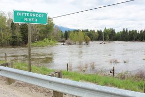
The flows in the Bitterroot River were trending steadily downward into Monday, reaching a low of 5.75 feet at the Darby Gage where Flood Stage is 7.5 feet. But after Monday, according to Luke Robertson at the National Weather Service in Missoula, the river was starting to inch up again and is expected to reach Flood Stage again on Friday afternoon.
The gage at Bell Crossing near Victor was also below Flood Stage on Monday, but is also headed upward and is expected to reach 11.03 feet, slightly over Flood Stage, on Friday afternoon.
The Bitterroot River at Missoula was slightly below flood stage on Monday but began rising again on Tuesday and is expected to rise to moderate Flood Stage of 12.14 feet by Friday evening.
On Monday, Robertson said some lowland flooding may occur around Darby and possibly some county roads but no homes were threatened in the area. He said the same holds true for the river between Lolo and Missoula where even more lowland flooding is expected along with potential flooding of county roads. There too, no homes are threatened.
On Monday, Montana Fish, Wildlife and Parks (FWP) closed the Clark Fork River to all recreation from Reserve Street Bridge in Missoula to Kona Bridge, due to dangers caused by downed power lines in the river and high-water levels full of hazardous debris.
The Incident Command for the Missoula 2018 Flood recommended the closure for public safety, after flood waters tipped power poles into the Clark Fork on Sunday. FWP says the closure will remain while power lines and other river debris are creating unsafe conditions.
The closure applies to all water-based recreation, including, but not limited to: wading, swimming, fishing, floating, boating.
For more information visit the FWP website at fwp.mt.gov/news/restrictions/.