Northern Rockies Team 5, Incident Commander Joe Sampson
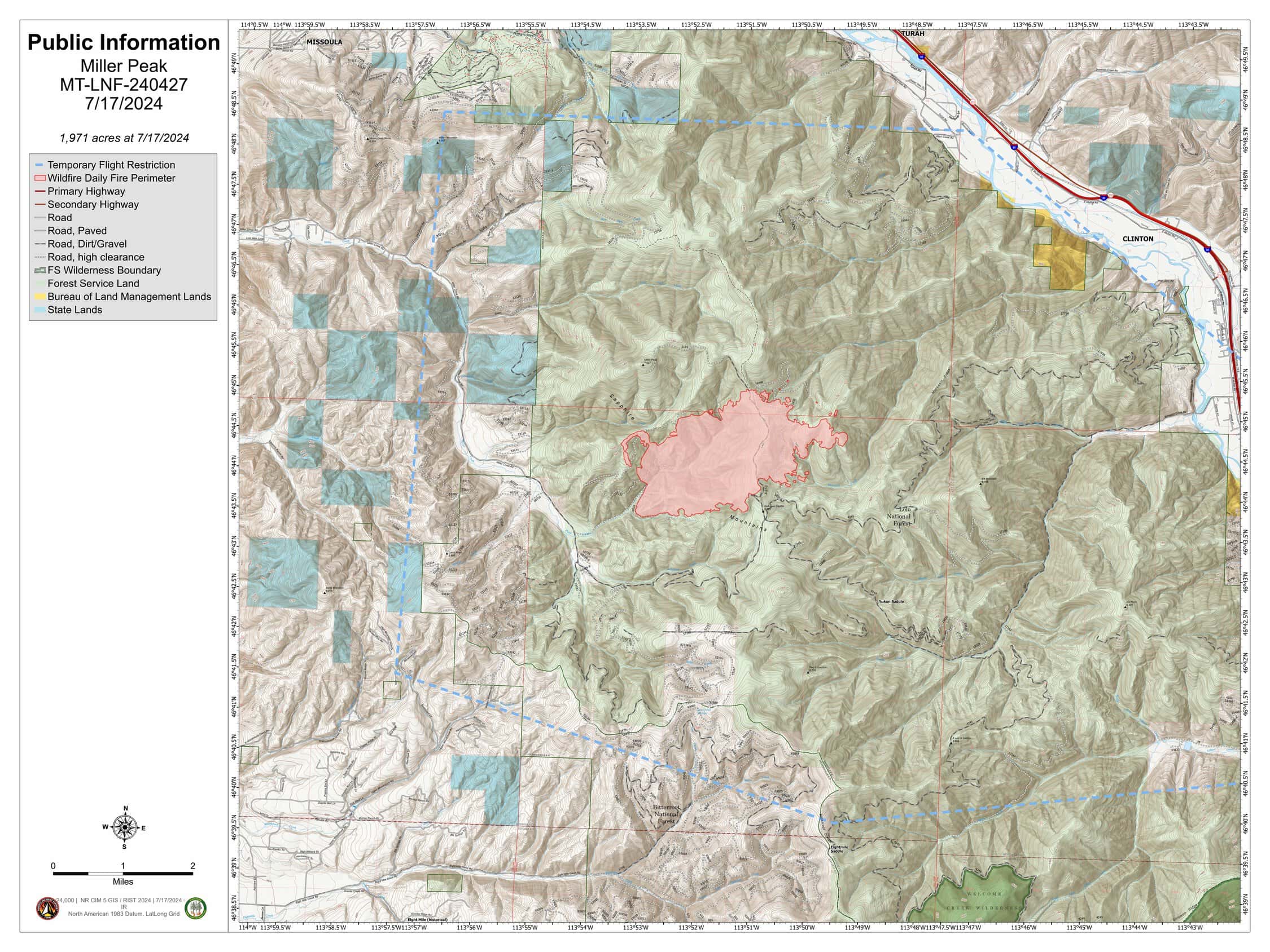
Location: 7 miles south of Missoula, MT
Start Date: 7/14/2024
Cause: Unknown
Size: 1,972 acres
Completion/Containment: 0%
166 Total Personnel; 6 Engines; 3 Helicopters; 4 Hand Crews;
KEY MESSAGE
There is an area and road closure in place on lands around the fire to ensure public and firefighter safety. Please respect all closure areas and allow firefighter crews, engines, and aircraft to work safely. This includes no drone flying in the temporary flight restriction area over the fire.
CURRENT STATUS
Aviation and crews continued to work constructing and strengthening line on the southern edge of the fire and progressing to Holloman Saddle and to the north toward Miller Peak, working to secure the edge. These actions are designed to protect the homes and structures in Miller Creek and the communications towers on Miller Peak. Crews
also continued to scout access and look for contingency options in the Moccasin Ridge area.
WEATHER AND FIRE BEHAVIOR
A ridge of high pressure over the region is expected to be impacted by a weak disturbance on Wednesday evening and overnight. This feature could generate scattered showers near the fire potentially causing gusty and erratic winds. The ridge strengthens on Thursday and through the weekend keeping temperatures well above seasonal
averages with low afternoon humidity readings. Strong overnight valley inversions are expected to redevelop causing poor overnight humidity recoveries for the upper portions of the fire.
CLOSURES
A temporary flight restriction is in effect over the fire area. An area and road closure around the fire is in effect due to hazardous conditions resulting from fire activity. Specific closure information and maps are posted on InciWeb at
https://inciweb.wildfire.gov/incident-information/mtlnf-miller-peak-fire and
https://www.fs.usda.gov/alerts/lolo/alerts-notices as they are implemented.