By Michael Howell
 Officials from the Federal Emergency Management Agency (FEMA) sponsored a community outreach meeting last week in Hamilton to explain the new Flood Insurance Rate Map for the county that has recently been released. The new map redefines the flood plain in places based on more accurate data.
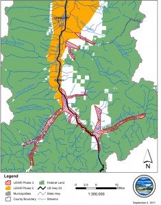
FEMA started the nationwide effort at updating its flood insurance maps and converting to a digital record in 2003. Using a process called LiDAR, the latest in digital map making technology, new maps of the Bitterroot River and some tributaries were made with an accuracy of one foot in elevation, although local officials said that the accuracy is even closer to a few inches in most places that have been checked.
FEMA Public Relations Officer Jerry DeFelice urged county residents to examine the new map because some homes that were once mapped as out of the flood plain may now be included. He warned that any residence re-located into a flood hazard zone may be required to get flood insurance if they have a federally backed mortgage.
Sean McNabb of FEMA told the County Commissioners earlier in the day that anything not modified by the new maps could not be appealed, but there were two ways to make changes in the map if errors are detected. McNabb said that if errors are discovered such as the wrong name for a road or some mistake in locating a landmark that the change could be made by making a comment to the agency pointing out the error. However, if errors in elevation are claimed that would change the designation of the area in which a residence or other structure is located the homeowner may appeal the designation on the map. But this appeal must be accompanied by scientific data, such as a survey, proving the error.
The appeal period, which has not yet begun, lasts 90 days following publication in the Federal Register, which has not yet been done. Once the appeal period is over the agency takes an undetermined amount of time to resolve the appeals. If resolved in favor of the landowner a Letter of Map Amendment (LOMA) is issued. McNabb said that although the appeal is granted the change will not be entered on the new map, usually due to the fact that the map scale is too large to show the area affected. The LOMA is attached to the map however, and County Flood Plain officials have a record of it. No timeline exists for final adoption of the map which would require a local Ordinance to be passed by the County Commission adopting it.
FEMA Insurance Specialist from Region 8, Norm Ashford, explained a special option being offered to homeowners who will now have to buy flood insurance. For policies effective on or after January 1, 2011 FEMA is applying the two-year Preferred Risk Policy extension for those buildings affected by map changes from October 1, 2008 to January 1, 2011 and buildings affected on or after January 1, 2011. Affected building owners are eligible for the low-cost PRP for two years from the map revision date. After that they may also be grandfathered in at a lower rate as well.
“This two-year extension provides affected property owners additional time to save and prepare for paying for the full risk premium,” said Ashford. “It also provides more time for the communities to upgrade or mitigate flood control structures to meet FEMA standards and reduce the flood risk.”
Further information about the process may be found on the FEMA website at www.msc.fema.gov or on the website www.FloodSmart.gov. or by calling the FEMA Map Information eXchange at 1-877-336-2627 or by contacting your local Flood Plain Administrator Brian Wilkinson at 375-6530.