by Nathan Boddy
The Bitterroot River will be waking up soon. Drift boats and rafts are behind many vehicles, and popular stretches are already lined with anglers. While the springtime high water is still a ways off, it bears mentioning that the Bitterroot River, while deceptively calm, is perhaps the most dangerous commonly floated stretch of water in Montana.
Three months from now, the river’s level will have returned to more placid flows, and not long after that, parades of sun seekers will enjoy its warm waters in inner tubes and a wide variety of floating devices. Many of them will have taken no safety measures whatsoever. Likewise, even now with frigid temperatures, few floaters enter the water with life jackets.
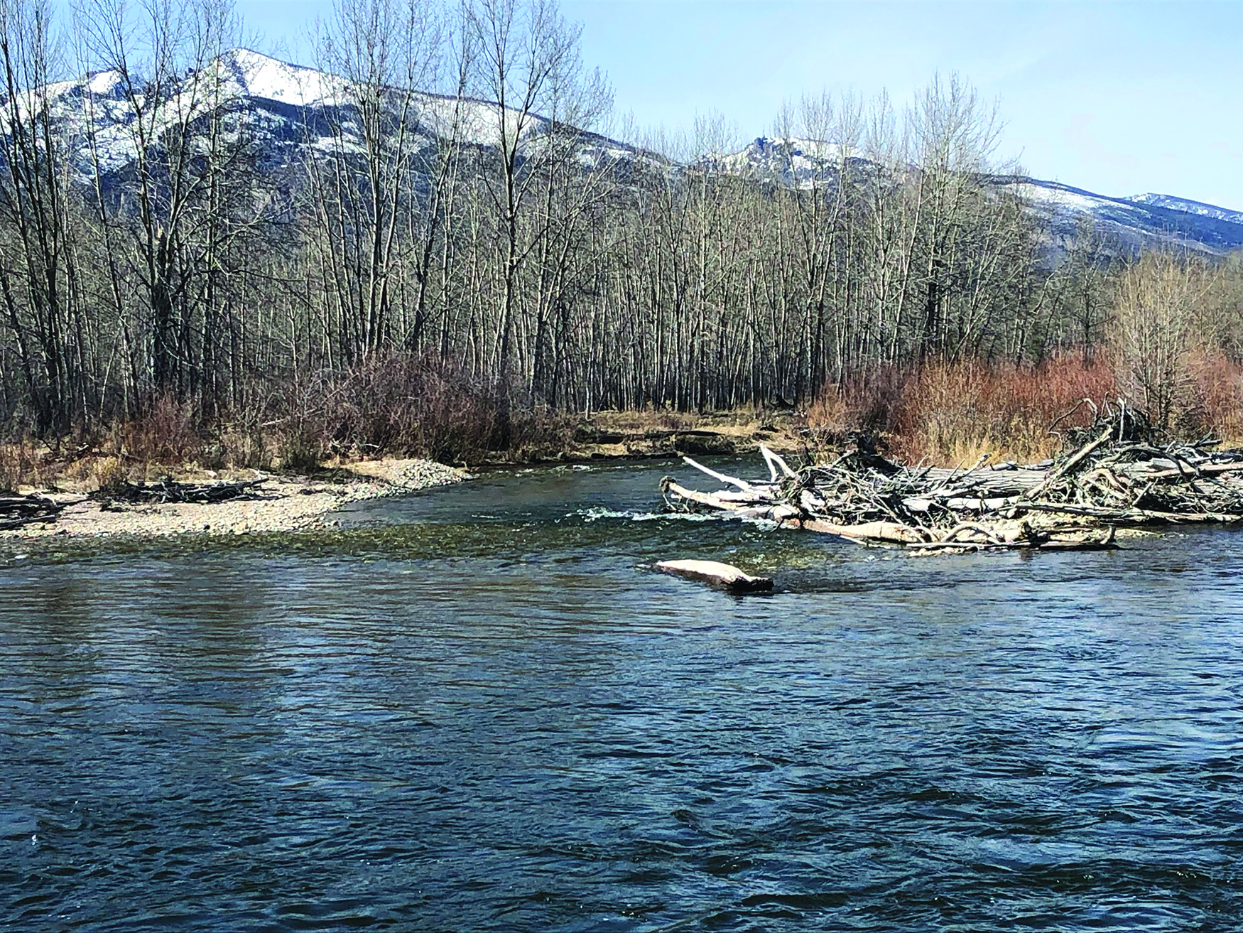
Although it has no rapids, the river seems to claim at least one life every year. Part of this unfortunate distinction is due to the river’s popularity, a fact which will undoubtedly continue to increase as so many people move into the valley. The other is that the Bitterroot River is a meandering river in a wooded valley, meaning that spring flood can quickly alter the flow, and add dangerous amounts of wood and debris to the channel.
Perhaps the most common danger encountered on the Bitterroot River are ‘strainers,’ features formed from clogged sections of woody debris such as downed trees or logjams. These can remain in place for extended periods of time, but could just as easily change within days or weeks. The threat they pose is that, like a pasta strainer, water can usually pass through them, but boats and bodies may not. Whether the water flows are high or low, the power of a strainer is likely to be far greater than even the strongest swimmers, especially when cold and exhausted.
High flows on the Bitterroot can be expected in May and June, during which time most anglers hang up their rods and wait for the river to ‘blow out,’ before heading back out. As a point of reference, the river flow as measured in CFS (cubic feet per second) during the last week has been hovering around 2000 at the USGS gauge near Bell Crossing. At peak flows in early June of 2021, that same gauge was reading over 11,000. But even if the river is running low, that doesn’t mean it isn’t without potential dangers.
“Do not underestimate the river at any level,” says Alan Burgmuller, a longtime resident of the Bitterroot Valley and member of WRI, the Whitewater Rescue Institute, which gives training seminars on swiftwater rescue. Burgmuller says that he’s seen things go bad on rivers at 5000 CFS almost as often as when the river is running at 800. He points out that the Bitterroot River has, on average, an access point every five miles or so, a point which makes it very attractive for recreation. But that same allure also causes people to think it’s both safe and easy to float. He points out that precautions, such as wearing a PFD (Personal floatation device), should always be taken.
“Get advice from local fly shops,” he says. “Ask which sections are good and what the conditions are.” Burgmuller also acknowledges that there is safety in numbers, and that a ‘one boat’ trip is exponentially more dangerous that a ‘two boat’ trip.
In addition to seeking local information and wearing a PFD, there are numerous maps of the river, its diversion dams and access points, available at local shops. There are also online apps that give up-to-the-minute water flow levels by linking to USGS gauges. Nothing, however, is a substitute for keeping eyes open and knowing one’s limits. This is important even as the water level begins to come down and the allure of a six pack and inner tube draw hundreds toward the river banks.